
Repeatable viewpoints
Agreed overview angles are revisited when operationally feasible to make visual comparison easier.
Repeatable aerial documentation for DFW projects
APS Drone helps builders, owners, developers and property teams document visible site progress with repeatable aerial viewpoints, date-labeled files and organized delivery across Dallas-Fort Worth.
Construction progress drone photography creates a consistent visual record of a job site over time. APS Drone offers weekly, biweekly and monthly DFW plans using agreed viewpoints so owners and project teams can compare milestones and communicate progress remotely.
Agreed overview angles are revisited when operationally feasible to make visual comparison easier.
Organized filenames and visit dates help teams locate and compare milestones without searching through mixed folders.
Wide aerial views show visible changes in access, grading, structures, staging and surrounding context.
Edited photos or optional short video can support owner reports, internal presentations and remote communication.
Consistent visual coverage helps teams communicate change across selected milestones.
Orthomosaic and 3D capture inputs can be scoped for planning and communication, but do not replace a licensed survey.
The $1,999 construction digital twin package adds a scheduled site capture, interactive 3D point cloud, selected photo locations and a portable offline viewer. It is a visual record of one capture date, not a survey or live model. Future captures are quoted separately.
Explore three digital twin demos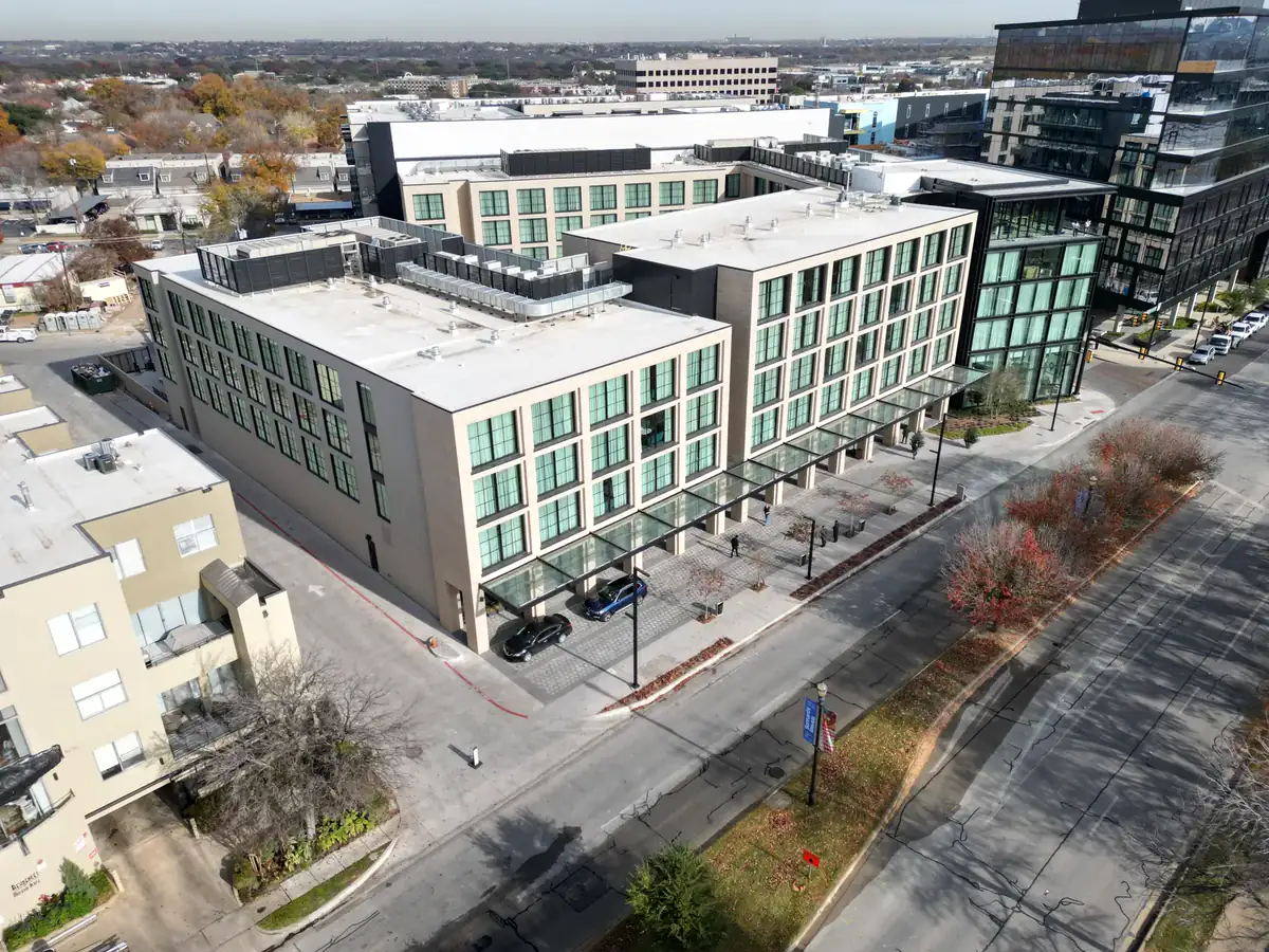
Share the site, schedule, stakeholders and required viewpoints.
Frequency, access, airspace, safety and deliverables are documented.
Agreed views are captured on the planned cadence when conditions allow.
Date-labeled files are delivered for comparison and stakeholder use.
Service details last reviewed: August 30, 2026.
Weekly, biweekly and monthly plans are available. Actual flights remain subject to airspace, weather, access and site safety.
Yes, agreed views are repeated when operationally feasible. Active equipment, cranes, temporary restrictions or safety conditions may require adjustments.
No. APS Drone provides visual documentation and mapping capture support, not a licensed land survey, engineering opinion or code inspection.
Pricing depends on the site, flight frequency, travel, access, airspace, number of viewpoints, photo or video deliverables and project duration.